
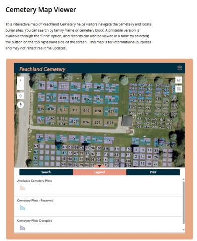
Peachland, B.C. – The District of Peachland has launched the PEACHLAND CEMETERY MAP VIEWER, an interactive map allowing users to virtually navigate the Peachland Cemetery and locate burial sites.
You can search by family name or cemetery block. The cemetery data is compiled from historical records dating back to the late 1890s. Some earlier burial records have been lost over time.
Find the map at www.peachland.ca/cemetery.
The map is provided for informational purposes and may not reflect real-time updates.
Peachland Cemetery
The Peachland Cemetery, located at the intersection of Elliott and Vernon Avenues, is always open to pedestrians through two unlocked access gates. Please contact the Operations Department to arrange access through the main gate or to arrange a burial.
250-767-2108
The Peachland Cemetery is thought to be one of the oldest in the Central Okanagan, established in the late 1890s. Some of the oldest grave markers date as far back as 1900. It is believed the Peachland Cemetery was donated by J.M. Robinson, the founder of Peachland, Summerland and Naramata. (Kelowna and District Genealogical Society, 2012)